
Thank you for supporting this site ❤️
Make a donation
Make a donation
Pandan topographic map
Click on the map to display elevation.
Thank you for supporting this site ❤️
Make a donation
Make a donation
About this map
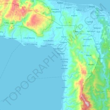
Name: Pandan topographic map, elevation, terrain.
Location: Pandan, Antique, Western Visayas, 5712, Philippines (11.61314 121.93865 11.82012 122.17865)
Average elevation: 143 m
Minimum elevation: -1 m
Maximum elevation: 1,054 m
Thank you for supporting this site ❤️
Make a donation
Make a donation