
Wadi Rum Protected Area topographic map
Interactive map
Click on the map to display elevation.
Wadi Rum Protected Area
The area is centered on the main valley of Wadi Rum. The highest elevation in Jordan is Jabal Umm ad Dami at 1,840 m (6,040 ft) high (SRTM data states 1854 m), located 30 kilometers south of Wadi Rum village. It was first located by Difallah Ateeg, a Zalabia Bedouin from Rum. On a clear day, it is possible to see the Red Sea and the Saudi border from the top.
About this map
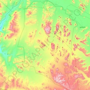
Name: Wadi Rum Protected Area topographic map, elevation, terrain.
Average elevation: 1,041 m
Minimum elevation: 589 m
Maximum elevation: 1,735 m
Other topographic maps
Click on a map to view its topography, its elevation and its terrain.