
Thank you for supporting this site ❤️
Make a donation
Make a donation
Tavarede topographic map
Click on the map to display elevation.
Thank you for supporting this site ❤️
Make a donation
Make a donation
About this map
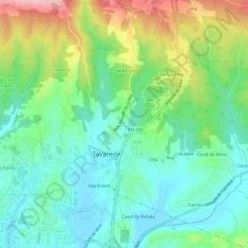
Name: Tavarede topographic map, elevation, terrain.
Location: Tavarede, Figueira da Foz, Coïmbre, Portugal (40.15162 -8.86216 40.18833 -8.81494)
Average elevation: 60 m
Minimum elevation: 3 m
Maximum elevation: 182 m
Thank you for supporting this site ❤️
Make a donation
Make a donation
Other topographic maps
Click on a map to view its topography, its elevation and its terrain.