
Thank you for supporting this site ❤️
Make a donation
Make a donation
Maheno topographic map
Click on the map to display elevation.
Thank you for supporting this site ❤️
Make a donation
Make a donation
About this map
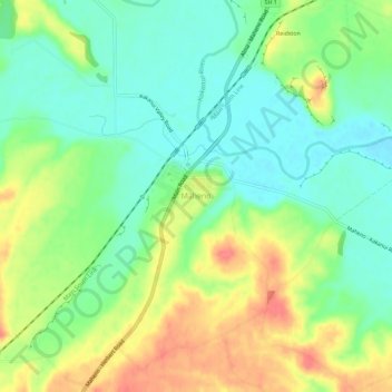
Name: Maheno topographic map, elevation, terrain.
Location: Maheno, Waitaki District, Otago, 9495, New Zealand (-45.18906 170.81797 -45.14906 170.85797)
Average elevation: 33 m
Minimum elevation: 7 m
Maximum elevation: 71 m
Waitaki District trails, hiking, mountain biking, running and outdoor activities
Thank you for supporting this site ❤️
Make a donation
Make a donation