
Thank you for supporting this site ❤️
Make a donation
Make a donation
Marche topographic map
Click on the map to display elevation.
Thank you for supporting this site ❤️
Make a donation
Make a donation
About this map
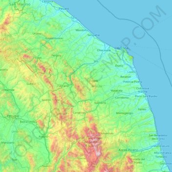
Name: Marche topographic map, elevation, terrain.
Location: Marche, Italy (42.68716 12.18545 43.97160 13.91634)
Average elevation: 337 m
Minimum elevation: -2 m
Maximum elevation: 2,445 m
Thank you for supporting this site ❤️
Make a donation
Make a donation
Other topographic maps
Click on a map to view its topography, its elevation and its terrain.