
Thank you for supporting this site ❤️
Make a donation
Make a donation
Ao Nang topographic map
Click on the map to display elevation.
Thank you for supporting this site ❤️
Make a donation
Make a donation
About this map
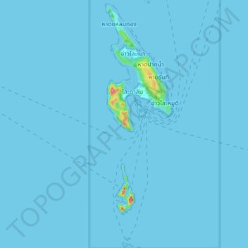
Name: Ao Nang topographic map, elevation, terrain.
Location: Ao Nang, Mueang Krabi District, Krabi Province, 81210, Thailand (7.65305 98.75249 7.79010 98.79730)
Average elevation: 3 m
Minimum elevation: 0 m
Maximum elevation: 295 m
Thank you for supporting this site ❤️
Make a donation
Make a donation
Other topographic maps
Click on a map to view its topography, its elevation and its terrain.