
Thank you for supporting this site ❤️
Make a donation
Make a donation
Lakeside topographic map
Click on the map to display elevation.
Thank you for supporting this site ❤️
Make a donation
Make a donation
About this map
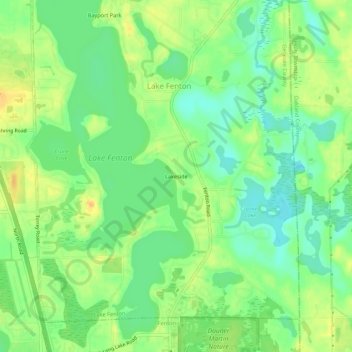
Name: Lakeside topographic map, elevation, terrain.
Location: Lakeside, Genesee County, Michigan, United States (42.81586 -83.72662 42.85586 -83.68662)
Average elevation: 268 m
Minimum elevation: 254 m
Maximum elevation: 283 m
Thank you for supporting this site ❤️
Make a donation
Make a donation
Other topographic maps
Click on a map to view its topography, its elevation and its terrain.
Thank you for supporting this site ❤️
Make a donation
Make a donation
Thank you for supporting this site ❤️
Make a donation
Make a donation
Thank you for supporting this site ❤️
Make a donation
Make a donation
Thank you for supporting this site ❤️
Make a donation
Make a donation