
Lobatera topographic map
Interactive map
Click on the map to display elevation.
About this map
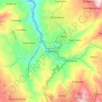
Name: Lobatera topographic map, elevation, terrain.
Location: Lobatera, Municipio Lobatera, Táchira, Venezuela (7.89006 -72.28783 7.97006 -72.20783)
Average elevation: 1,228 m
Minimum elevation: 793 m
Maximum elevation: 1,773 m
Other topographic maps
Click on a map to view its topography, its elevation and its terrain.