
Thank you for supporting this site ❤️
Make a donation
Make a donation
Logo de Deus topographic map
Click on the map to display elevation.
Thank you for supporting this site ❤️
Make a donation
Make a donation
About this map
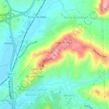
Name: Logo de Deus topographic map, elevation, terrain.
Location: Logo de Deus, Coimbra, 3020-928, Portugal (40.26325 -8.42945 40.26335 -8.42935)
Average elevation: 54 m
Minimum elevation: 13 m
Maximum elevation: 145 m
Thank you for supporting this site ❤️
Make a donation
Make a donation
Other topographic maps
Click on a map to view its topography, its elevation and its terrain.