
Thank you for supporting this site ❤️
Make a donation
Make a donation
Paynes Find topographic map
Click on the map to display elevation.
Thank you for supporting this site ❤️
Make a donation
Make a donation
About this map
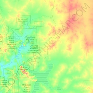
Name: Paynes Find topographic map, elevation, terrain.
Location: Paynes Find, Shire Of Yalgoo, Western Australia, Australia (-29.80145 116.93353 -28.40696 118.28386)
Average elevation: 363 m
Minimum elevation: 276 m
Maximum elevation: 656 m
Thank you for supporting this site ❤️
Make a donation
Make a donation
Other topographic maps
Click on a map to view its topography, its elevation and its terrain.
Thank you for supporting this site ❤️
Make a donation
Make a donation
Thank you for supporting this site ❤️
Make a donation
Make a donation