
Whistler Resort Municipality topographic map
Interactive map
Click on the map to display elevation.
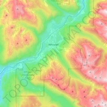
Whistler Resort Municipality topographic map, elevation, terrain
About this map
Name: Whistler Resort Municipality topographic map, elevation, terrain.
Average elevation: 1,343 m
Minimum elevation: 499 m
Maximum elevation: 2,607 m
Other topographic maps
Click on a map to view its topography, its elevation and its terrain.
Rubble Creek
Canada > British Columbia > Squamish-Lillooet Regional District > Area D (Elaho/Garibaldi)
Average elevation: 787 m
Whistler Village
Canada > British Columbia > Squamish-Lillooet Regional District > Whistler Resort Municipality > Whistler Village
Average elevation: 775 m