
Thank you for supporting this site ❤️
Make a donation
Make a donation
Kolthoorn topographic map
Click on the map to display elevation.
Thank you for supporting this site ❤️
Make a donation
Make a donation
About this map
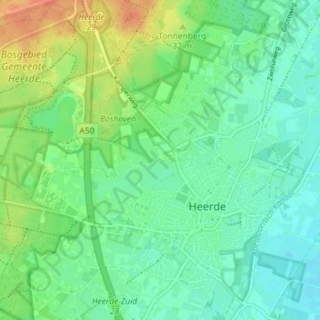
Name: Kolthoorn topographic map, elevation, terrain.
Location: Kolthoorn, Heerde, Gelderland, Nederland, 8181 CR, Nederland (52.37548 6.00985 52.41548 6.04985)
Average elevation: 15 m
Minimum elevation: 1 m
Maximum elevation: 41 m
Thank you for supporting this site ❤️
Make a donation
Make a donation