
Thank you for supporting this site ❤️
Make a donation
Make a donation
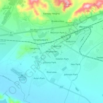
Worcester topographic map
Click on the map to display elevation.
Thank you for supporting this site ❤️
Make a donation
Make a donation
Worcester
Worcester is located at an elevation of 220 metres (720 ft) and can be reached by road either travelling on the N1 highway through the Huguenot Tunnel or by driving through spectacular mountain passes. From Cape Town Du Toitskloof, from Wellington Bainskloof, from Malmesbury, Western Cape Nieuwekloof, from Ceres Mitchells, from Robertson Goree, from Hermanus Rooihoogte and from Johannesburg Hex River, with vistas over the Hex River Valley.
Thank you for supporting this site ❤️
Make a donation
Make a donation
About this map
Name: Worcester topographic map, elevation, terrain.
Average elevation: 252 m
Minimum elevation: 195 m
Maximum elevation: 525 m
Thank you for supporting this site ❤️
Make a donation
Make a donation