
Bodzentyn topographic map
Click on the map to display elevation.
About this map
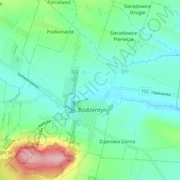
Name: Bodzentyn topographic map, elevation, terrain.
Average elevation: 299 m
Minimum elevation: 258 m
Maximum elevation: 423 m
Other topographic maps
Click on a map to view its topography, its elevation and its terrain.
Góry Świętokrzyskie
Poland > Holy Cross Voivodeship > Kielce County > Kakonin
Average elevation: 440 m