
Thank you for supporting this site ❤️
Make a donation
Make a donation
Ticad topographic map
Click on the map to display elevation.
Thank you for supporting this site ❤️
Make a donation
Make a donation
About this map
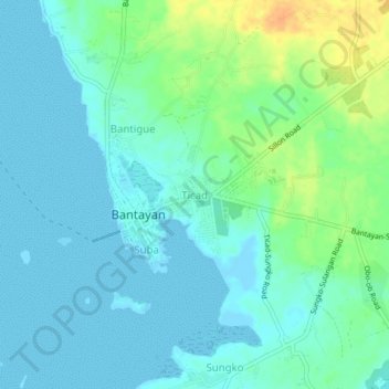
Name: Ticad topographic map, elevation, terrain.
Location: Ticad, Cebu, Central Visayas, 6062, Philippines (11.14961 123.70486 11.18961 123.74486)
Average elevation: 9 m
Minimum elevation: -2 m
Maximum elevation: 33 m
Thank you for supporting this site ❤️
Make a donation
Make a donation
Other topographic maps
Click on a map to view its topography, its elevation and its terrain.