
Belvedere topographic map
Interactive map
Click on the map to display elevation.
About this map
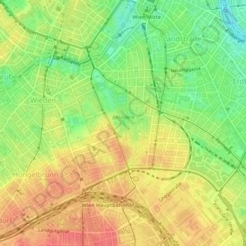
Name: Belvedere topographic map, elevation, terrain.
Average elevation: 190 m
Minimum elevation: 157 m
Maximum elevation: 216 m
Other topographic maps
Click on a map to view its topography, its elevation and its terrain.
KG Landstraße
KG Landstraße, Landstraße, Vienna, 1030, Austria
Average elevation: 180 m