Geolocate

Pangboche topographic map

Interactive map

Click on the map to display elevation.

Pangboche topographic map, elevation, terrain

Pangboche topographic map, elevation, terrain

Pangboche

Pangboche or Panboche is a village in Khumjung Village Development Committee of Solukhumbu District in Province No. 1 of Nepal at an altitude of 13,074 feet (3,985 m). It is located high in the Himalayas in the Imja Khole valley, about 3 kilometres northeast of Tengboche and is a base camp for climbing the nearby Ama Dablam and trekking. It contains a monastery, famed for its purported yeti scalp and hand, the latter of which was stolen. The village is inhabited mainly by Sherpas, and Sungdare Sherpa, a native of the village, held the record for summiting Everest five times in the Sherpa climbing history and in the world history of mountaineering in 1989. The Pangboche school was built by Sir Edmund Hillary's Himalayan Trust in 1963. North of the village is the Dughla lake and pass.

Wikipedia (CC-BY-SA 3.0)

About this map

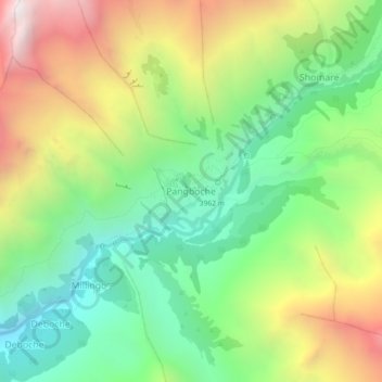
Name: Pangboche topographic map, elevation, terrain.

Location: Pangboche, Khumbupasanglahmu, Solukhumbu, Koshi Province, Nepal (27.83578 86.77017 27.87578 86.81017)

Average elevation: 4,303 m

Minimum elevation: 3,617 m

Maximum elevation: 5,355 m

Other topographic maps

Click on a map to view its topography, its elevation and its terrain.

Lhotse

Nepal > Koshi Province > Solukhumbu

Lhotse (Nepali: ल्होत्से, romanized: L'hōtsē [lotse]; Standard Tibetan: ལྷོ་རྩེ, romanized: lho tse, lit. 'South Peak' [l̥otse]; Chinese: 洛子峰) is the fourth-highest mountain on Earth, after Mount Everest, K2, and Kangchenjunga. At an elevation of 8,516 metres (27,940…

Average elevation: 7,391 m

Ama Dablam

Nepal > Koshi Province > Solukhumbu

Ama Dablam was first climbed on 13 March 1961 by Mike Gill (NZ), Barry Bishop (US), Mike Ward (UK) and Wally Romanes (NZ) via the Southwest Ridge. They were well-acclimatised to altitude, having wintered over at 5,800 metres (19,029 ft) near the base of the peak as part of the 1960–61 Silver Hut expedition,…

Average elevation: 5,625 m

Mount Everest

Nepal > Koshi Province > Solukhumbu

Mount Everest (Nepali: सगरमाथा, romanized: Sagarmāthā; Standard Tibetan: ཇོ་མོ་གླང་མ, romanized: Chomolungma; Chinese: 珠穆朗玛峰; pinyin: Zhūmùlǎngmǎ Fēng) is Earth's highest mountain above sea level, located in the Mahalangur Himal sub-range of the Himalayas.…

Average elevation: 7,847 m

Khumjung

Nepal > Koshi Province > Solukhumbu

Khumjung (Nepali: खुम्जुंग) is a village in Khumbu Pasanglhamu rural municipality of Solukhumbu District in Province No. 1 of north-eastern Nepal. It is located in the Khumbu subregion inside Sagarmatha National Park, a world heritage site. The village is at an elevation of 3,790 metres above…

Average elevation: 3,888 m

Mount Everest

Nepal > Koshi Province > Solukhumbu

Mount Everest (Nepali: सगरमाथा, romanized: Sagarmāthā; Tibetan: Chomolungma ཇོ་མོ་གླང་མ; Chinese: 珠穆朗玛峰; pinyin: Zhūmùlǎngmǎ Fēng) is Earth's highest mountain above sea level, located in the Mahalangur Himal sub-range of the Himalayas. The China–Nepal…

Average elevation: 7,850 m

Himalayas

Nepal > Koshi Province > Solukhumbu

The Himalayas, or Himalaya (/ˌhɪməˈleɪ.ə, hɪˈmɑːləjə/; Sanskrit: [ɦɪmaːlɐjɐ]; from Sanskrit himá 'snow, frost', and ā-laya 'dwelling, abode'), is a mountain range in Asia, separating the plains of the Indian subcontinent from the Tibetan Plateau. The range has some of the planet's highest…

Average elevation: 7,555 m