
Neufels topographic map
Interactive map
Click on the map to display elevation.
About this map
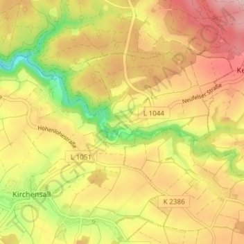
Name: Neufels topographic map, elevation, terrain.
Average elevation: 335 m
Minimum elevation: 235 m
Maximum elevation: 413 m
Other topographic maps
Click on a map to view its topography, its elevation and its terrain.
Tannen
Deutschland > Baden-Württemberg > Hohenlohekreis > Neuenstein
Tannen, Neuenstein, Verwaltungsverband Hohenloher Ebene, Hohenlohekreis, Baden-Württemberg, 74638, Deutschland
Average elevation: 341 m
Obersöllbach
Deutschland > Baden-Württemberg > Hohenlohekreis > Neuenstein > Obersöllbach
Obersöllbach, Neuenstein, Verwaltungsverband Hohenloher Ebene, Hohenlohekreis, Baden-Württemberg, 74632, Deutschland
Average elevation: 301 m