
Thank you for supporting this site ❤️
Make a donation
Make a donation
Hadleigh topographic map
Click on the map to display elevation.
Thank you for supporting this site ❤️
Make a donation
Make a donation
About this map
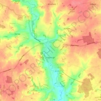
Name: Hadleigh topographic map, elevation, terrain.
Location: Hadleigh, Babergh, Suffolk, England, United Kingdom (52.02726 0.90728 52.07018 1.01588)
Average elevation: 51 m
Minimum elevation: 11 m
Maximum elevation: 78 m
Thank you for supporting this site ❤️
Make a donation
Make a donation
Other topographic maps
Click on a map to view its topography, its elevation and its terrain.