
Saint-Joseph-de-Rivière topographic map
Interactive map
Click on the map to display elevation.
About this map
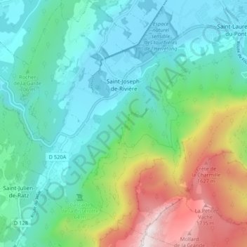
Name: Saint-Joseph-de-Rivière topographic map, elevation, terrain.
Average elevation: 791 m
Minimum elevation: 392 m
Maximum elevation: 1,896 m