Geolocate

Ainamoi topographic map

Interactive map

Click on the map to display elevation.

Ainamoi topographic map, elevation, terrain

Ainamoi topographic map, elevation, terrain

About this map

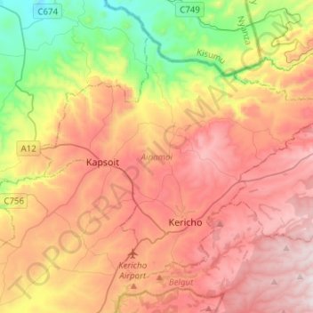
Name: Ainamoi topographic map, elevation, terrain.

Location: Ainamoi, Kericho County, Rift Valley, Kenya (-0.41173 35.16703 -0.21693 35.41567)

Average elevation: 1,832 m

Minimum elevation: 1,293 m

Maximum elevation: 2,335 m

Other topographic maps

Click on a map to view its topography, its elevation and its terrain.

Kamasian ward

Kenya > Kericho County > Kipkelion West

Average elevation: 2,054 m

Kipkelion West

Kenya > Kericho County

Average elevation: 2,014 m

Belgut

Kenya > Kericho County

Average elevation: 1,960 m

Kipkelion East

Kenya > Kericho County

Average elevation: 2,411 m

Sigowet

Kenya > Kericho County > Sigowet/Soin > Kaplerartet ward

Average elevation: 1,713 m