
Längelmävesi topographic map
Interactive map
Click on the map to display elevation.
About this map
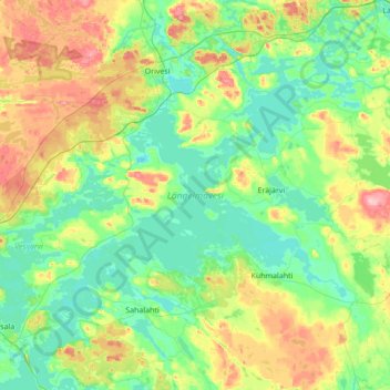
Name: Längelmävesi topographic map, elevation, terrain.
Average elevation: 113 m
Minimum elevation: 79 m
Maximum elevation: 201 m
Längelmävesi (Finnish pronunciation: [ˈlæŋːelmæˌʋesi]) is a lake in southwestern Finland. The lake is located mostly in the Pirkanmaa region at an elevation of 84.2 metres (276 ft). Längelmävesi is within the municipalities of Jämsä (formerly Längelmäki), Kangasala (formerly Sahalahti), Kuhmalahti, and Orivesi.