
Blanchet topographic map
Interactive map
Click on the map to display elevation.
About this map
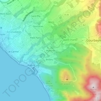
Name: Blanchet topographic map, elevation, terrain.
Location: Blanchet, Gourbeyre, Basse-Terre, Guadeloupe, 97113, France (15.97095 -61.72991 16.01095 -61.68991)
Average elevation: 185 m
Minimum elevation: 0 m
Maximum elevation: 641 m