
Enping City topographic map
Interactive map
Click on the map to display elevation.
About this map
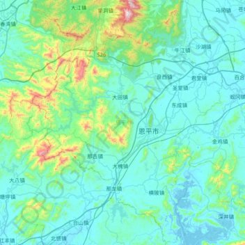
Name: Enping City topographic map, elevation, terrain.
Location: Enping City, Jiangmen City, Guangdong, PRC (21.91134 111.99921 22.49763 112.52528)
Average elevation: 139 m
Minimum elevation: -5 m
Maximum elevation: 1,171 m
Other topographic maps
Click on a map to view its topography, its elevation and its terrain.