
Adams County topographic map
Interactive map
Click on the map to display elevation.
About this map
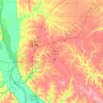
Name: Adams County topographic map, elevation, terrain.
Location: Adams County, Illinois, United States (39.75665 -91.51305 40.20036 -90.91046)
Average elevation: 196 m
Minimum elevation: 134 m
Maximum elevation: 261 m
Other topographic maps
Click on a map to view its topography, its elevation and its terrain.
Sturbridge Village
United States > Illinois > Winnebago County > Sturbridge Village
Average elevation: 230 m