
Somerset topographic map
Interactive map
Click on the map to display elevation.
About this map
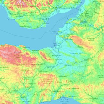
Name: Somerset topographic map, elevation, terrain.
Average elevation: 96 m
Minimum elevation: -4 m
Maximum elevation: 562 m
Other topographic maps
Click on a map to view its topography, its elevation and its terrain.
Ditcheat
United Kingdom > England > Mendip > Ditcheat
Ditcheat, Mendip, Somerset, South West England, England, BA4 6PN, United Kingdom
Average elevation: 64 m
Mendip
United Kingdom > England > Mendip
Mendip, Somerset, South West England, England, United Kingdom
Average elevation: 98 m