
Te Kuiti topographic map
Interactive map
Click on the map to display elevation.
About this map
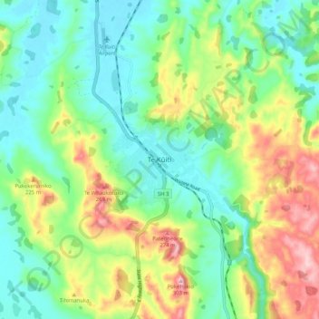
Name: Te Kuiti topographic map, elevation, terrain.
Location: Te Kuiti, Waitomo District, Waikato, 3910, New Zealand (-38.37419 175.12571 -38.29419 175.20571)
Average elevation: 130 m
Minimum elevation: 45 m
Maximum elevation: 298 m
Waitomo District trails, hiking, mountain biking, running and outdoor activities
Other topographic maps
Click on a map to view its topography, its elevation and its terrain.