
Thank you for supporting this site ❤️
Make a donation
Make a donation
Marokopa River topographic map
Click on the map to display elevation.
Thank you for supporting this site ❤️
Make a donation
Make a donation
About this map
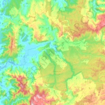
Name: Marokopa River topographic map, elevation, terrain.
Location: Marokopa River, Waitomo District, Waikato, New Zealand (-38.30744 174.71421 -38.23798 174.95450)
Average elevation: 216 m
Minimum elevation: 0 m
Maximum elevation: 599 m
Waitomo District trails, hiking, mountain biking, running and outdoor activities
Thank you for supporting this site ❤️
Make a donation
Make a donation
Other topographic maps
Click on a map to view its topography, its elevation and its terrain.