
Pontypridd topographic map
Interactive map
Click on the map to display elevation.
About this map
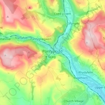
Name: Pontypridd topographic map, elevation, terrain.
Location: Pontypridd, Rhondda Cynon Taf, Wales, United Kingdom (51.56162 -3.38181 51.63670 -3.26428)
Average elevation: 183 m
Minimum elevation: 37 m
Maximum elevation: 380 m
Other topographic maps
Click on a map to view its topography, its elevation and its terrain.