
Pulau Mantanani Besar topographic map
Interactive map
Click on the map to display elevation.
About this map
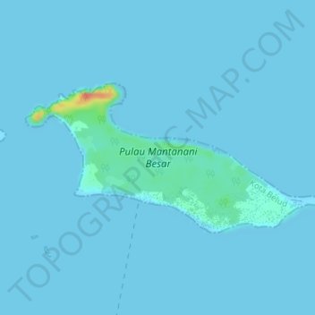
Name: Pulau Mantanani Besar topographic map, elevation, terrain.
Location: Pulau Mantanani Besar, Sabah, Malaysia (6.70554 116.33869 6.72054 116.37052)
Average elevation: 2 m
Minimum elevation: 0 m
Maximum elevation: 57 m
Other topographic maps
Click on a map to view its topography, its elevation and its terrain.