
Maitai Dam topographic map
Interactive map
Click on the map to display elevation.
About this map
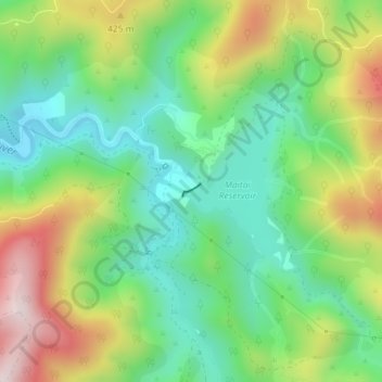
Name: Maitai Dam topographic map, elevation, terrain.
Location: Maitai Dam, Nelson, New Zealand (-41.29434 173.36982 -41.29346 173.37144)
Average elevation: 293 m
Minimum elevation: 102 m
Maximum elevation: 615 m
Other topographic maps
Click on a map to view its topography, its elevation and its terrain.
Dew Lakes
New Zealand > Nelson > Nelson
Dew Lakes, Saddle Hill Route, Nelson, New Zealand
Average elevation: 800 m
Wakapuaka River
New Zealand > Nelson > Nelson
Wakapuaka River, Nelson, 7071, New Zealand
Average elevation: 164 m
Whangamoa River
New Zealand > Nelson > Nelson
Whangamoa River, Nelson, New Zealand
Average elevation: 225 m