
Buluan topographic map
Interactive map
Click on the map to display elevation.
About this map
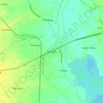
Name: Buluan topographic map, elevation, terrain.
Location: Buluan, Maguindanao del Sur, Bangsamoro, 9616, Philippines (6.67662 124.74659 6.75662 124.82659)
Average elevation: 16 m
Minimum elevation: 7 m
Maximum elevation: 31 m
Other topographic maps
Click on a map to view its topography, its elevation and its terrain.
Liguasan Marsh
Philippines > Maguindanao del Sur > General Salipada K. Pendatun
Average elevation: 9 m