India topographic maps
Click on a map to view its topography, its elevation and its terrain.
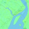
Haldia
India > West Bengal > Haldia
Haldia is located at 22°02′N 88°04′E / 22.03°N 88.06°E / 22.03; 88.06. It has an average elevation of 8 metres (26 ft).
Average elevation: 3 m
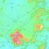
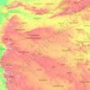
Maharashtra
Maharashtra is the third largest state by area in India. The Western Ghats better known as Sahyadri, are a hilly range running parallel to the coast, at an average elevation of 1,200 metres (4,000 ft). Kalsubai, a peak in the Sahyadris, near Nashik city is the highest elevated point in Maharashtra. To the west…
Average elevation: 478 m
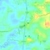

Kolkata
Spread roughly north–south along the east bank of the Hooghly River, Kolkata sits within the lower Ganges Delta of eastern India approximately 75 km (47 mi) west of the international border with Bangladesh; the city's elevation is 1.5–9 m (5–30 ft). Much of the city was originally a wetland that was…
Average elevation: 5 m




Dakshina Kannada
The topography of the district is plain up to 30 km (18.64 mi) inside the coast and changes to undulating hilly terrain sharply towards the east in the Western Ghats. Teak, bamboo and rosewood trees are found in the hilly areas towards the east. The Geological Survey of India has identified this district as a…
Average elevation: 109 m
Chandigarh
Chandigarh is located by the foothills of the Shivalik Range of the Himalayas in northwest India. It covers an area of approximately 114 km2. It borders the states of Punjab and Haryana. The exact geographic coordinates of Chandigarh are 30°44′N 76°47′E / 30.74°N 76.79°E / 30.74; 76.79. It has…
Average elevation: 343 m



Chikhaldara
The sole hill resort in the Vidarbha region, it is situated at an altitude of 1118 meters with highest elevation point 1188 meters and has the added dimension of being the only coffee-growing area in Maharashtra. Chikhaldara has an annual rainfall of 154cm. Temperatures vary from 39C in summer to 5C in winter.…
Average elevation: 521 m










Uttarakhand
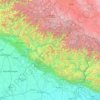
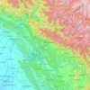
Uttarakhand lies on the southern slope of the Himalaya range, and the climate and vegetation vary greatly with elevation, from glaciers at the highest elevations to subtropical forests at the lower elevations. The highest elevations are covered by ice and bare rock. Below them, between 3,000 and 5,000 metres…
Average elevation: 2,102 m

Betul
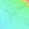
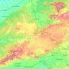
The mean elevation above the sea is about 2000 ft. The country is essentially a highland tract, divided naturally into three distinct portions, differing in their superficial aspects, the character of their soil and their geological formation. The northern part of the district forms an irregular plain of the…
Average elevation: 533 m




Ramganga River
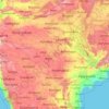
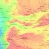
The Ramganga River originates in the southern slopes of Dudhatoli Hill in Chamoli district of the Indian state of Uttarakhand. The source of the river, known as "Diwali Khal", is located in Gairsain tehsil at 30°05′00″N 79°18′00″E / 30.08333°N 79.30000°E / 30.08333; 79.30000. The river…
Average elevation: 438 m



Lansdowne
India > Uttarakhand > Lansdowne
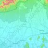
Lansdowne is a quaint hill station in the Pauri Garhwal district of Uttarakhand, India. Lodged in the picturesque surroundings of the Himalayan ranges, it lies at an elevation of approximately 1,700 meters (5,577 feet) above sea level. The town is about 45 kilometers (28 miles) from the district headquarters,…
Average elevation: 1,140 m






Gurudongmar
India > Sikkim > Chungthang
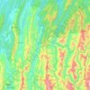
Gurudongmar Lake is one of the highest lakes in the world and in India, at an elevation of 5,430 m (17,800 ft) according to the Government of Sikkim. It is located in the Great Himalayas in the Mangan District in Indian state of Sikkim, and considered sacred by Buddhists and Sikhs. The lake is named after…
Average elevation: 5,232 m



Karauli
The Chambal River forms the southeastern boundary of the district with the state of Madhya Pradesh, around 5 kilometres (3.1 mi) away from Mandrayal. Although most of Karauli district is composed of hills and valleys, there are no high mountains, with the highest having an elevation less than 450 metres (1,480…
Average elevation: 263 m

Kolhapur District
Kolhapur experiences winter from November to February. The winter temperatures are warmer than other cities in Maharashtra such as Pune and Nashik. Lows range from 9 to 16 °C (48 to 61 °F) while highs are in the range of 24 to 32 °C (75 to 90 °F) due to its high elevation and being adjacent to the Western…
Average elevation: 464 m

Kollam
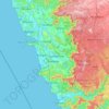
Kallada Boat race is one of the famous festival events of the district. Even though it is a competition between two land sides of the river, many boat clubs from various places, even beyond the district participate in the event. Kollam is known as the capital of Kerala's cashew industry. Plains, mountains,…
Average elevation: 203 m


Zone 12 Alandur
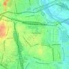
India > Tamil Nadu > Alandur > Chennai
Alandur is located at 13°02′N 80°13′E / 13.03°N 80.21°E / 13.03; 80.21. It has an average elevation of 12 metres (39 ft).
Average elevation: 12 m