
Laceby topographic map
Interactive map
Click on the map to display elevation.
About this map
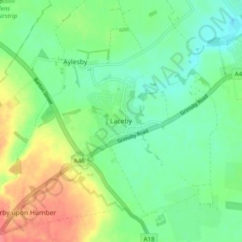
Name: Laceby topographic map, elevation, terrain.
Average elevation: 24 m
Minimum elevation: 1 m
Maximum elevation: 64 m
Other topographic maps
Click on a map to view its topography, its elevation and its terrain.
Humberston
United Kingdom > England > North East Lincolnshire
Humberston, North East Lincolnshire, England, United Kingdom
Average elevation: 7 m
Grimsby
United Kingdom > England > North East Lincolnshire
Grimsby, North East Lincolnshire, England, DN31 1NR, United Kingdom
Average elevation: 6 m