Geolocate

Årdal topographic map

Interactive map

Click on the map to display elevation.

About this map

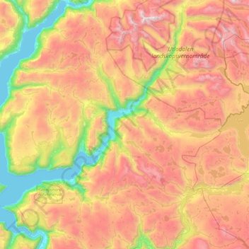
Name: Årdal topographic map, elevation, terrain.

Location: Årdal, Vestland, Noruega (61.11088 7.37808 61.46120 8.25145)

Average elevation: 1,067 m

Minimum elevation: 0 m

Maximum elevation: 2,334 m

Other topographic maps

Click on a map to view its topography, its elevation and its terrain.

Voss

Noruega > Vestland

Voss, Vestland, Noruega

Average elevation: 765 m

Øygarden

Noruega > Vestland

Øygarden, Vestland, Noruega

Average elevation: 14 m

Stryn

Noruega > Vestland

Stryn, Vestland, Noruega

Average elevation: 882 m

Lærdal

Noruega > Vestland

Lærdal, Vestland, Noruega

Average elevation: 1,155 m

Bergen

Noruega > Vestland

Bergen, Vestland, Noruega

Average elevation: 125 m