
Belait District topographic map
Interactive map
Click on the map to display elevation.
About this map
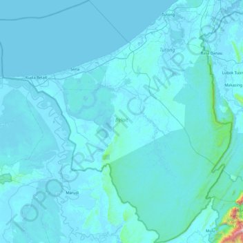
Name: Belait District topographic map, elevation, terrain.
Location: Belait District, Brunei (4.00251 113.99995 4.88777 114.85806)
Average elevation: 45 m
Minimum elevation: -3 m
Maximum elevation: 2,332 m
Other topographic maps
Click on a map to view its topography, its elevation and its terrain.