
Thank you for supporting this site ❤️
Make a donation
Make a donation
Buzet topographic map
Click on the map to display elevation.
Thank you for supporting this site ❤️
Make a donation
Make a donation
About this map
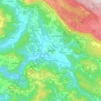
Name: Buzet topographic map, elevation, terrain.
Location: Buzet, Grad Buzet, Istria County, 52420, Croatia (45.36788 13.92559 45.44788 14.00559)
Average elevation: 234 m
Minimum elevation: 22 m
Maximum elevation: 707 m
Thank you for supporting this site ❤️
Make a donation
Make a donation
Other topographic maps
Click on a map to view its topography, its elevation and its terrain.