
Sihunta topographic map
Click on the map to display elevation.
About this map
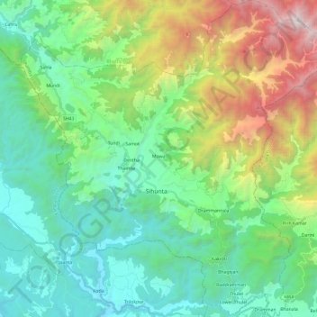
Name: Sihunta topographic map, elevation, terrain.
Location: Sihunta, Chamba, Himachal Pradesh, India (32.22230 75.98830 32.42170 76.22165)
Average elevation: 1,339 m
Minimum elevation: 501 m
Maximum elevation: 3,603 m
Other topographic maps
Click on a map to view its topography, its elevation and its terrain.