
Midhirst topographic map
Interactive map
Click on the map to display elevation.
About this map
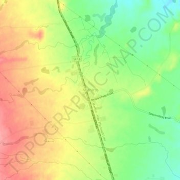
Name: Midhirst topographic map, elevation, terrain.
Location: Midhirst, Stratford District, Taranaki, 4332, New Zealand (-39.31087 174.24665 -39.27087 174.28665)
Average elevation: 342 m
Minimum elevation: 295 m
Maximum elevation: 388 m
Other topographic maps
Click on a map to view its topography, its elevation and its terrain.
Manganui River
Manganui River, Midhirst, Stratford District, Taranaki, 4642, New Zealand
Average elevation: 527 m