
Tchoukotka topographic map
Interactive map
Click on the map to display elevation.
About this map
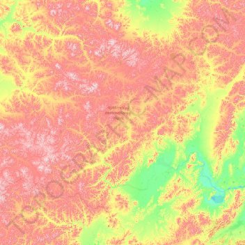
Name: Tchoukotka topographic map, elevation, terrain.
Location: Tchoukotka, District fédéral extrême-oriental, Russie (63.44065 166.93009 68.56065 172.05009)
Average elevation: 435 m
Minimum elevation: -1 m
Maximum elevation: 1,665 m
Other topographic maps
Click on a map to view its topography, its elevation and its terrain.
Île Wrangel
Île Wrangel, городской округ Эгвекинот, Tchoukotka, District fédéral extrême-oriental, Russie
Average elevation: 168 m