
Thank you for supporting this site ❤️
Make a donation
Make a donation
Iruhin West topographic map
Click on the map to display elevation.
Thank you for supporting this site ❤️
Make a donation
Make a donation
About this map
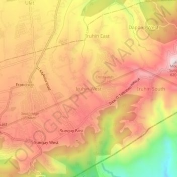
Name: Iruhin West topographic map, elevation, terrain.
Location: Iruhin West, Tagaytay, Cavite, Calabarzon, 4120, Philippines (14.11589 120.98175 14.15589 121.02175)
Average elevation: 498 m
Minimum elevation: 121 m
Maximum elevation: 728 m
Thank you for supporting this site ❤️
Make a donation
Make a donation
Other topographic maps
Click on a map to view its topography, its elevation and its terrain.