
Konan topographic map
Interactive map
Click on the map to display elevation.
About this map
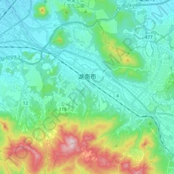
Name: Konan topographic map, elevation, terrain.
Location: Konan, Shiga Prefecture, Japan (34.94659 136.03624 35.05677 136.14218)
Average elevation: 230 m
Minimum elevation: 100 m
Maximum elevation: 671 m
Other topographic maps
Click on a map to view its topography, its elevation and its terrain.