
Thank you for supporting this site ❤️
Make a donation
Make a donation
Bukit Tinggi topographic map
Click on the map to display elevation.
Thank you for supporting this site ❤️
Make a donation
Make a donation
About this map
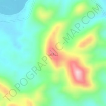
Name: Bukit Tinggi topographic map, elevation, terrain.
Location: Bukit Tinggi, Maran, Pahang, Malaysia (3.49499 102.71623 3.49509 102.71633)
Average elevation: 108 m
Minimum elevation: 14 m
Maximum elevation: 278 m
Thank you for supporting this site ❤️
Make a donation
Make a donation
Other topographic maps
Click on a map to view its topography, its elevation and its terrain.