
Thank you for supporting this site ❤️
Make a donation
Make a donation
Tinderet topographic map
Click on the map to display elevation.
Thank you for supporting this site ❤️
Make a donation
Make a donation
About this map
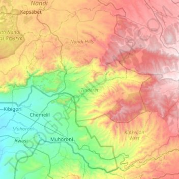
Name: Tinderet topographic map, elevation, terrain.
Location: Tinderet, Nandi County, Rift Valley, Kenya (-0.10975 34.93817 0.07326 35.43891)
Average elevation: 1,883 m
Minimum elevation: 1,174 m
Maximum elevation: 2,863 m
Thank you for supporting this site ❤️
Make a donation
Make a donation