
Aldai topographic map
Interactive map
Click on the map to display elevation.
About this map
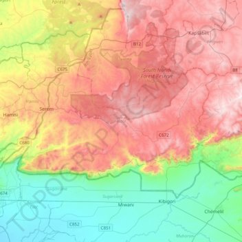
Name: Aldai topographic map, elevation, terrain.
Location: Aldai, Nandi County, Rift Valley, Kenya (-0.03663 34.74030 0.15273 35.13048)
Average elevation: 1,608 m
Minimum elevation: 1,139 m
Maximum elevation: 2,176 m
Other topographic maps
Click on a map to view its topography, its elevation and its terrain.