
Marakwet West topographic map
Interactive map
Click on the map to display elevation.
About this map
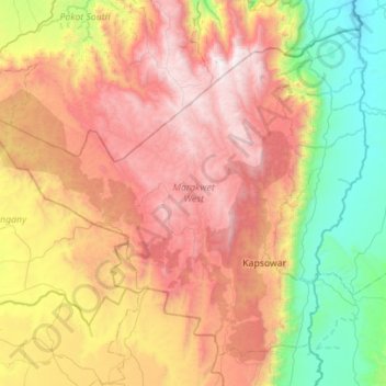
Name: Marakwet West topographic map, elevation, terrain.
Location: Marakwet West, Elgeyo-Marakwet County, Rift Valley, Kenya (0.84454 35.15229 1.31682 35.70972)
Average elevation: 2,056 m
Minimum elevation: 906 m
Maximum elevation: 3,509 m
Other topographic maps
Click on a map to view its topography, its elevation and its terrain.