
Thank you for supporting this site ❤️
Make a donation
Make a donation
Mells topographic map
Click on the map to display elevation.
Thank you for supporting this site ❤️
Make a donation
Make a donation
About this map
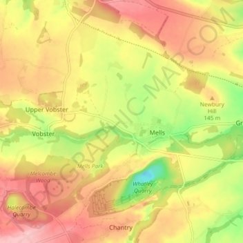
Name: Mells topographic map, elevation, terrain.
Location: Mells, Somerset, England, United Kingdom (51.21919 -2.43410 51.26484 -2.36910)
Average elevation: 133 m
Minimum elevation: 43 m
Maximum elevation: 200 m
Thank you for supporting this site ❤️
Make a donation
Make a donation
Other topographic maps
Click on a map to view its topography, its elevation and its terrain.