
Laprak topographic map
Interactive map
Click on the map to display elevation.
About this map
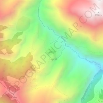
Name: Laprak topographic map, elevation, terrain.
Location: Laprak, Dharche, गोरखा, Gandaki, Népal (28.19915 84.78140 28.23915 84.82140)
Average elevation: 2,317 m
Minimum elevation: 1,491 m
Maximum elevation: 3,206 m
Other topographic maps
Click on a map to view its topography, its elevation and its terrain.
Ārughāt Bāzār
Ārughāt Bāzār, Aarughat, गोरखा, Gandaki, Népal
Average elevation: 676 m