
Ārughāt Bāzār topographic map
Interactive map
Click on the map to display elevation.
About this map
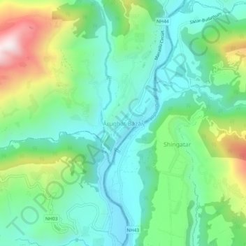
Name: Ārughāt Bāzār topographic map, elevation, terrain.
Location: Ārughāt Bāzār, Aarughat, गोरखा, Gandaki, Népal (28.02623 84.79238 28.06623 84.83238)
Average elevation: 676 m
Minimum elevation: 462 m
Maximum elevation: 1,202 m
Other topographic maps
Click on a map to view its topography, its elevation and its terrain.