
West Oxfordshire topographic map
Interactive map
Click on the map to display elevation.
About this map
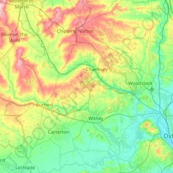
Name: West Oxfordshire topographic map, elevation, terrain.
Location: West Oxfordshire, Oxfordshire, England, United Kingdom (51.68381 -1.71950 51.99685 -1.28615)
Average elevation: 119 m
Minimum elevation: 55 m
Maximum elevation: 273 m
Other topographic maps
Click on a map to view its topography, its elevation and its terrain.
Kingston Bagpuize
United Kingdom > England > Oxfordshire > Vale of White Horse
Average elevation: 76 m
Tusmore
United Kingdom > England > Oxfordshire > Cherwell District > Hardwick
Average elevation: 119 m